Short answer: a drone survey normally delivers an orthomosaic (a measurable aerial map), a surface model and a terrain model, contours, and drawings or GIS layers of the features. LiDAR surveys add a classified point cloud. Each comes in standard formats that open in CAD and GIS software.
The main deliverables
| Deliverable | What it is | Used for | Usual formats |
|---|---|---|---|
| Orthomosaic | A single aerial image corrected so that distances can be measured on it | Base map, features, progress, encroachments | GeoTIFF, ECW, KMZ |
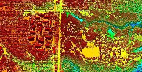
| DSM | Surface model of the top of everything: ground, buildings, trees | Obstacles, heights, line-of-sight | GeoTIFF |
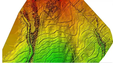
| DTM | Bare-earth terrain model with buildings and vegetation removed | Design, drainage, earthwork, flood studies | GeoTIFF, LandXML |
| Contours | Lines of equal height from the DTM | Drawings and layouts | DWG, DXF, SHP |
| Point cloud | Millions of 3D points, classified as ground, vegetation, buildings, wires | Corridors, power lines, detailed terrain | LAS, LAZ |
| CAD drawings | Features drawn as lines and blocks: roads, tracks, structures, utilities | DPRs, ESPs, yard plans, as-builts | DWG, DXF, PDF |
| GIS layers | Features with attributes for analysis | Asset registers, land records, planning | SHP, GeoPackage, KML |
| Accuracy report | Checkpoint errors (RMSE) in X, Y and Z | Proving the survey is fit for purpose |
DSM or DTM?
The DSM includes trees and buildings; the DTM removes them to show the ground. Designers and quantity surveyors almost always need the DTM. Under dense vegetation a reliable DTM needs LiDAR or ground survey, because photos only see the canopy.
Agree these before the survey starts
- Coordinate system and height datum (for example a UTM zone and the vertical datum the design uses)
- GSD of the orthomosaic and grid size of the elevation models
- Contour interval and drawing layers
- Point-cloud classes, if LiDAR is flown
- File formats and software versions your team uses
For accuracy, read how accurate a drone survey is.