In short: water that a canal or river carries in surplus is drawn off, carried along two lines and put back into the ground through recharge structures. DATA PKT surveys the corridors with drones and DGPS and designs the system on that survey: the off-take, the alignment and levels of each line, the crossings and the recharge structures.
The need
Mahendragarh is a semi-arid district in southern Haryana. Farms and villages draw most of their water from the ground, rainfall is short and seasonal, and groundwater levels have been falling for years. Canals and rivers carry more water at some times of the year than is used. A recharge system stores that surplus underground, where it does not evaporate and can be pumped back by wells across the area.
How the recharge system works
The system is designed as a chain, from the source to the aquifer. Each link is sized from the survey levels and the water that can be drawn:
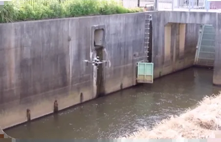
- Off-take at the canal or river: an intake with a regulator or gate, so water is drawn only when it is available and in the quantity allowed.
- Silt control: a desilting or sedimentation chamber and filter, because silt that reaches a recharge well clogs it.
- Conveyance lines: the two lines, about 45 km and 15 km, laid to an alignment and gradient that move water by gravity wherever the ground allows.
- Crossings: structures where the lines cross roads, railways, other canals, drains and utilities.
- Recharge structures: recharge wells and shafts, percolation pits and recharge ponds, and existing village ponds revived to hold and soak water, placed where the ground can take it.
- Escapes and monitoring: outlets for excess water, and points to watch water levels so the effect can be measured.
How drones make the design possible
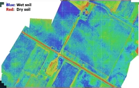
A recharge network is a long, linear project across farmland and villages. Designing it needs the levels and features of every kilometre, and a conventional ground survey of 60 km would take weeks. A drone survey tied to DGPS ground control captures the corridors in days and gives the designers the whole picture at once.
| Survey output | What the designer uses it for |
|---|---|
| Orthomosaic of each corridor | Choosing an alignment that avoids houses, wells, trees and difficult land, and keeps crossings to a minimum |
| Terrain model and contours | Checking that water can flow by gravity, fixing gradients and finding where pumping or drops are needed |
| Longitudinal and cross-sections | Depth of the line, trench and earthwork quantities, and levels at every structure |
| Overlay on khasra (revenue) maps | The land each kilometre passes through, so land and right-of-way needs are known early |
| Inventory of crossings and utilities | Every road, railway, canal, drain and service line the network must cross, with its position and level |
| Low ground, depressions and village ponds | Candidate recharge sites, where water collects naturally and can be held to soak in |
| Canal or river section at the off-take | Bed and water levels for the intake design, with bathymetry where the water is deep |
Why drones are faster
A conventional ground survey with DGPS and total station measures one point at a time, so a team covers a small area each day and a long corridor takes weeks. A DATA PKT drone team captures around 5 sq km of survey data in a day, which is then mapped and analysed in the office. On a linear corridor such as a highway, one team captures about 35 km of drone imagery for photogrammetry, or about 50 km of aerial video, in a day, and DATA PKT has more than 20 drone pilots (a team of about 22) to put in the field. Ground instruments are still used, but only where they matter most: for the control points that fix the map to real coordinates, for checkpoints that prove the accuracy, and for detail the drone cannot see.
How we run the survey and design
- Desk study: canal and river records, existing maps and groundwater information for the area.
- Reconnaissance: the off-take point, the possible routes and the recharge sites are walked and photographed.
- DGPS control: ground control points and benchmarks are set along both corridors, so every map and level is tied to real coordinates.
- Drone mapping: the 45 km and 15 km corridors are flown and processed into orthomosaics, terrain models and contours.
- Ground survey: levels at the canal or river, at crossings and at structure sites are checked with DGPS and total station.
- Design: alignment, longitudinal sections, hydraulic sizing of the lines, and drawings of the off-take, silt chambers, crossings and recharge structures.
- Hand-over: drawings, sections, quantities and the survey data, in CAD and GIS formats.
Other irrigation, canal and river surveys
The same methods serve irrigation and water departments on other work: longitudinal and cross-sections of canals, distributaries and drains; bathymetry of rivers, reservoirs and canal beds; mapping of regulators, falls, bridges and outfalls; encroachments and lining condition along canal banks; flood-plain and river-course mapping; and command-area maps for irrigation planning. See drone surveys for water resources.