In short: railways need accurate plans of each yard before remodelling or drainage works. Measuring yards on foot beside running lines is slow and risky. DATA PKT flies each yard, builds an orthomosaic and terrain model, and drafts the yard plan or drainage design from it, with critical details checked on the ground.
Eastern India: 30 yard plans and 31 drainage plans
Under two contracts awarded in January 2026, each with a six-month completion period, DATA PKT prepared yard plans for 23 yards, plus 7 more added during the work, and drainage plans for 31 yards, from suburban yards to junctions on the main line. All 30 yard plans and all 31 drainage plans have been submitted.
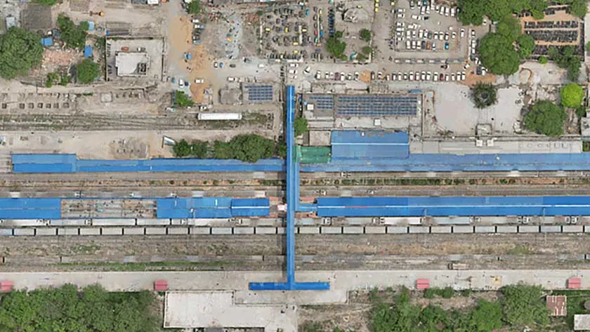
Uttar Pradesh and Madhya Pradesh: drainage design for 32 yards
The contract, awarded in June 2026 for completion in six months, covers planning and design of drainage in 32 existing yards, from small wayside stations to junctions. The railway asked for LiDAR or an equivalent advanced survey method. DATA PKT has completed the ground survey of all 32 yards, and drainage plans are being prepared and submitted for approval.
For each yard the work covers:
- A survey report with site conditions and levels
- An estimate of waste water generated in the yard
- Drainage slopes and the disposal location
- Manholes and septic tanks with dispersal trenches, sized for the yard, with a cleaning arrangement
- Layout plans for the railway's approval
How the work runs
- Control: surveyors fix DGPS ground control points around the yard.
- Flight: the drone captures the whole yard in one short window, with little time spent beside running lines.
- Processing: an orthomosaic and terrain model are built and checked against independent checkpoints.
- Drafting: tracks, turnouts, platforms, structures, drains and levels are drawn into the yard plan or drainage design.
- Field check and approval: critical details are verified on the ground, and plans are revised until approved.
Why drones are faster
A conventional ground survey with DGPS and total station measures one point at a time, so a team covers a small area each day and a long corridor takes weeks. A DATA PKT drone team captures around 5 sq km of survey data in a day, which is then mapped and analysed in the office. On a linear corridor such as a highway, one team captures about 35 km of drone imagery for photogrammetry, or about 50 km of aerial video, in a day, and DATA PKT has more than 20 drone pilots (a team of about 22) to put in the field. Ground instruments are still used, but only where they matter most: for the control points that fix the map to real coordinates, for checkpoints that prove the accuracy, and for detail the drone cannot see.
Other railway work
DATA PKT has also carried out level-crossing surveys in two divisions (18 and more than 15 level crossings), railway bridge inspections, and location plans for traction substations and sectioning posts, described in our 220/132 kV substation and transmission line case study.
Read more: Engineering Scale Plans and DPR surveys and what an ESP is.