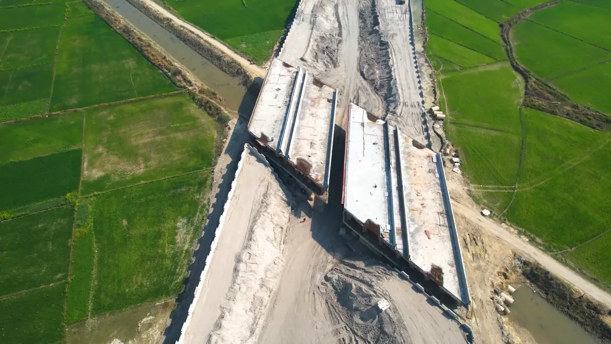
In short: every month our pilots fly each highway package along the same path, tied to DGPS ground control. The imagery becomes georeferenced maps (photogrammetry), the video becomes the comparative monthly record, and both feed analytics that measure the rate of completion and flag anomalies on completed highways.
Scale and speed
What a drone service provider does
Highway drone programmes separate two roles. The drone service provider (DSP) works in the field and on the data: it flies the highway, captures it and turns it into information. The technology service provider (TSP) runs the technology platform the data goes into. As a DSP, DATA PKT delivers:
- DGPS ground control, so every map is tied to real coordinates
- Drone photogrammetry: georeferenced orthomosaics and measurements of each package
- Aerial videography: the comparative monthly video
- Analytics on that data, including AI analytics, described below
What the analytics find
| Finding | Why it matters to the highway owner |
|---|---|
| Rate of completion on projects under construction | Progress measured month on month, not estimated |
| Encroachments and broken boundaries along the right of way | Land and ROW protection; evidence for action |
| Unauthorised U-turns and paths cut by the public where traffic rules are not followed | Points to close, regularise or redesign |
| Potholes and surface damage | Maintenance targeted where it is needed |
| Black spots and accident-prone stretches | Corrections planned and amendments checked in later flights |
| Visual condition of the corridor | What an inspector would note on a site walk, captured for every kilometre and tracked over time |
Why drones are faster
A conventional ground survey with DGPS and total station measures one point at a time, so a team covers a small area each day and a long corridor takes weeks. A DATA PKT drone team captures around 5 sq km of survey data in a day, which is then mapped and analysed in the office. On a linear corridor such as a highway, one team captures about 35 km of drone imagery for photogrammetry, or about 50 km of aerial video, in a day, and DATA PKT has more than 20 drone pilots (a team of about 22) to put in the field. Ground instruments are still used, but only where they matter most: for the control points that fix the map to real coordinates, for checkpoints that prove the accuracy, and for detail the drone cannot see.
Why highways need a monthly drone record
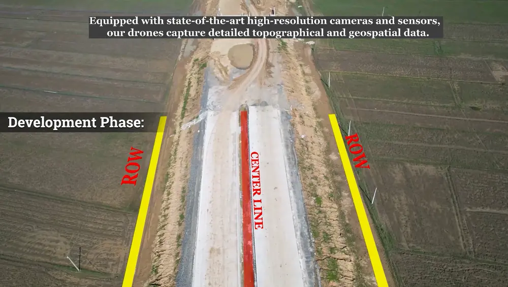
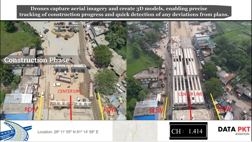
In 2021 NHAI made drone video recording mandatory for national highway projects, every month, at every stage: development, construction, and operation and maintenance (Mobility Outlook, June 2021). Videos compare the current month with the previous one and can be used as evidence in disputes. Contractors and private developers use the same record for their own progress reports and billing.
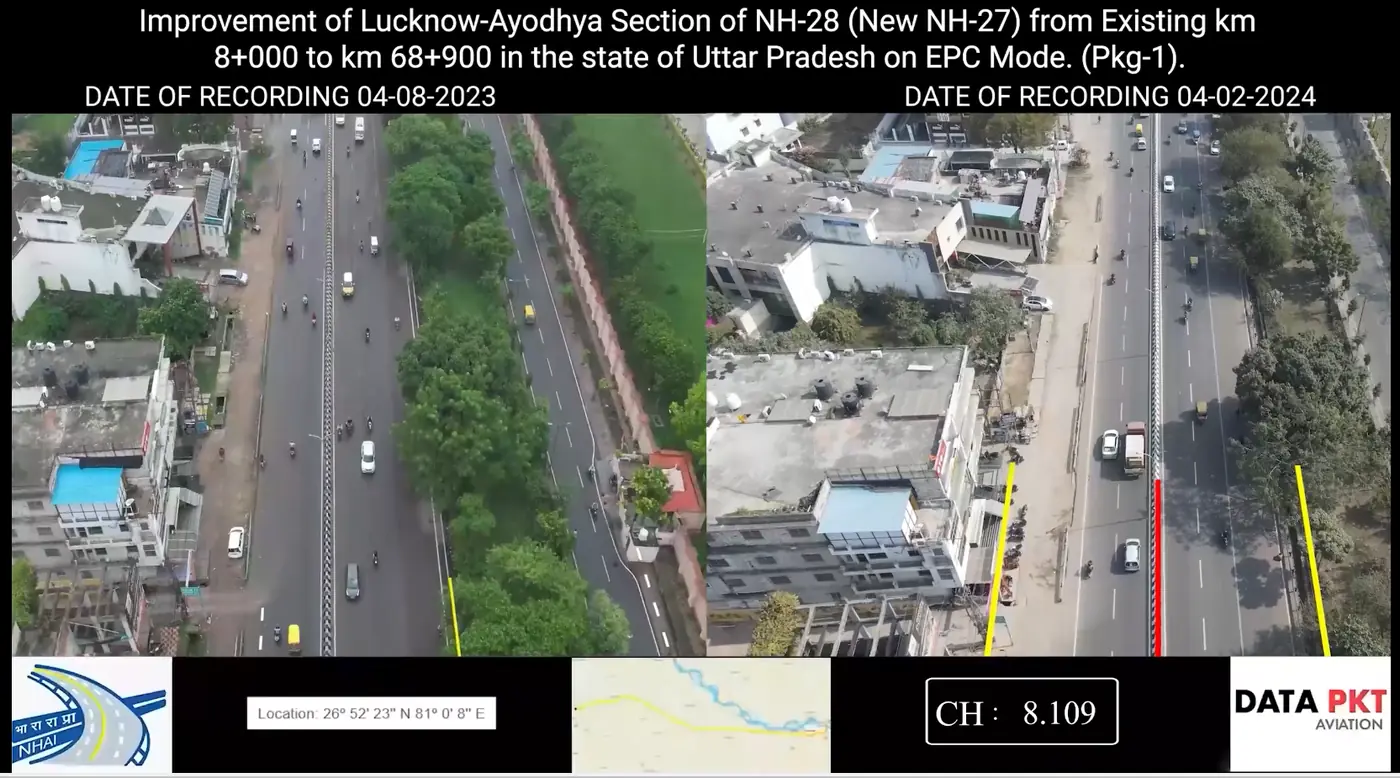
How a monthly cycle runs
- Package plan: chainages, flight path and camera settings are fixed once, so every month is flown the same way.
- Control and permissions: DGPS ground control is set, and stretches in yellow or red airspace zones are cleared before the flight date.
- Flight: DATA PKT pilots fly the full length of the package.
- Processing and analytics: orthomosaics, the comparative video and the analytics are prepared in the office.
- Hand-over: files go to the client's monthly progress report and data portal.
How it started
Our first highway drone work, in October 2020, was aerial imagery, videography and survey for highway projects in Nagaland and Manipur. It grew into NHAI empanelment in three zones and a client base that mixes highway authorities, including NHAI, NHIDCL and the Border Roads Organisation, with more than 80 highway contractors and private developers, among them G R Infraprojects, PNC Infratech, H.G. Infra Engineering, Ceigall India, IRB Infrastructure and AFCONS.