Short answer: choose photogrammetry for open ground when you want a true-colour map at the lowest cost. Choose LiDAR when the ground is under trees, when you need power lines or thin structures in 3D, or when the terrain is steep and forested. Long corridors often use both.
How each one works
Photogrammetry builds a map and 3D model from hundreds of overlapping photos. Software matches the same points across photos to work out their positions. LiDAR fires laser pulses from the drone and times their return. Some pulses pass through gaps in leaves and reach the ground, which is why LiDAR can map terrain under a canopy.
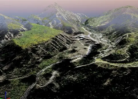
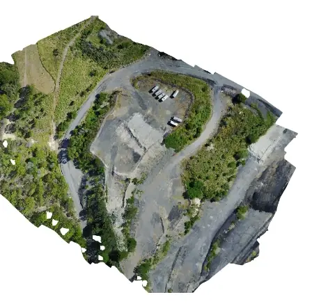
Side by side
| Photogrammetry | LiDAR | |
|---|---|---|
| Ground under trees | No: maps the top of the canopy | Yes: pulses reach the ground through gaps |
| Accuracy on open ground | A few centimetres with RTK/PPK and GCPs | A few centimetres with good control |
| True-colour map | Yes, the orthomosaic is the main output | Needs an added camera |
| Wires and thin structures | Poor | Good: conductors and towers appear in the cloud |
| Water, glass, uniform sand | Weak: few features to match | Weak on water; better on uniform ground |
| Cost | Lower | Higher |
| Main deliverables | Orthomosaic, DSM, DTM, contours, 3D mesh | Classified point cloud, DTM, DSM, contours, sections |
Which to choose, by project
| Project | Usual choice | Why |
|---|---|---|
| Highway DPR on open plains | Photogrammetry + DGPS | Economical, and the orthomosaic shows every feature |
| Hill road through forest | LiDAR | The ground is hidden under trees |
| Transmission line route | LiDAR | Clearances, vegetation and conductors in 3D |
| Railway yard ESP | Photogrammetry + ground checks | Tracks and structures are clearly visible from above |
| Mine and stockpile volumes | Photogrammetry | Open surfaces; frequent, low-cost repeat flights |
| Flood and catchment studies | LiDAR | Bare-earth terrain over large, vegetated areas |
Not sure? Tell us the site and what the survey is for; we will recommend one method or a combination. See LiDAR surveys and photogrammetry.