In short: we are a GIS mapping company in Gurugram with an in-house team working in ArcGIS, QGIS and AutoCAD. We build GIS layers from our own drone and LiDAR surveys or from your data, overlay them on revenue and forest maps, and deliver files your engineers can use directly. For firms outside India we provide remote GIS data processing and dedicated offshore seats.
GIS services for projects in India
- GIS layers from drone and LiDAR surveys: orthomosaics, elevation models and contours brought into GIS with roads, structures, utilities, drainage and land use mapped as layers
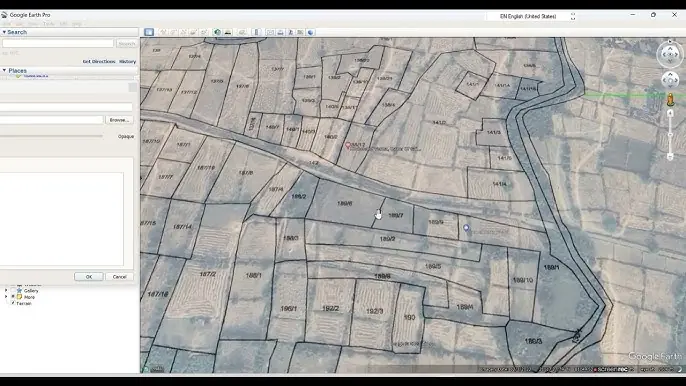
- Drone maps on khasra (revenue) maps: current ground conditions laid over plot boundaries, so land acquisition and right-of-way planning start from facts
- Forest diversion and approval maps: KML, KMZ and shapefiles of the project boundary and affected land, prepared for forest and other clearances
- Corridor and asset mapping for highways, railways, transmission lines, canals and pipelines
- Land-use and land-cover mapping for planning and environmental studies
- GIS to CAD: survey and GIS data converted into DWG and DXF drawings for design teams
Remote GIS data processing for firms outside India
Engineering, survey and GIS firms in the Middle East, Europe, the US and Australia send us their data and we return finished GIS and CAD outputs. This is data processing only; we do not do field survey outside India.
- Digitisation and vectorisation of maps, plans and imagery
- Feature extraction from orthomosaics and point clouds
- Point cloud classification and terrain models
- Map production, attribute work and data clean-up to your QC rules
- Dedicated offshore seats: a team in India that works only on your projects, full time or part time, under your procedures and confidentiality terms
Formats and standards
We deliver in shapefile, geodatabase, GeoPackage, KML/KMZ, GeoTIFF, DWG or DXF, in the coordinate system, projection and height datum you specify, with layer naming and attribute schemas to your template. Every job is checked against the QC rules agreed at the start.
Related services
GIS work often starts with our drone photogrammetry or LiDAR surveys; see also transmission line route surveys on khasra maps and drone survey deliverables explained.